
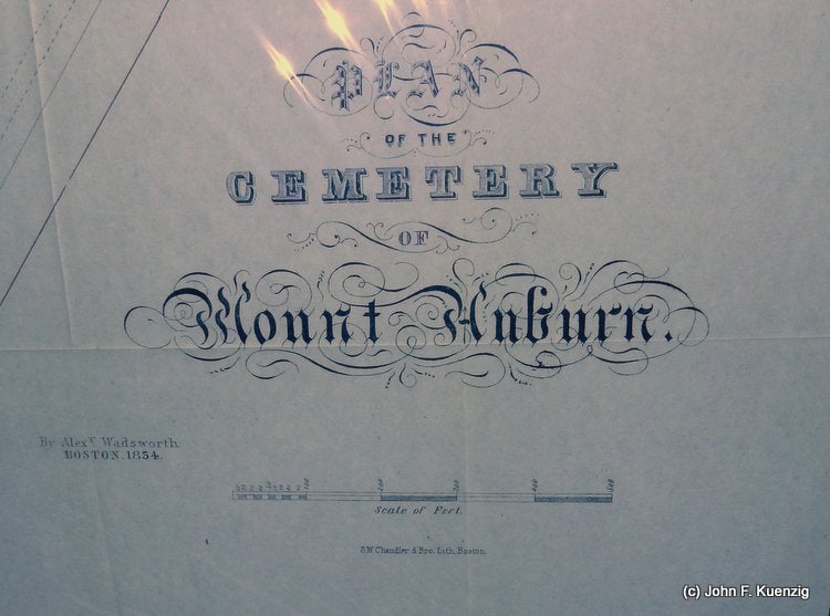
Plan of the Cemetery of Mount Auburn
Boston, Massachusetts: S. W. Chandler & Bro. Lith 1854. Approx. 22 1/4 x 28 1/2 inches. Thin paper, black printing. Previously folded (roughly 5 x 8 1/4 inches). Bright and clean, trimmed mostly to black borders on right and left, larger margins top and bottom. Near Fine. [27961]
“Mount Auburn Cemetery is the first rural, or garden, cemetery in the United States, located on the line between Cambridge and Watertown in Middlesex County, Massachusetts, 4 miles (6.4 km) west of Boston. It is the burial site of many prominent members of the Boston Brahmins, as well being a National Historic Landmark. Dedicated in 1831 and set with classical monuments in a rolling landscaped terrain, it marked a distinct break with Colonial-era burying grounds and church-affiliated graveyards. The appearance of this type of landscape coincides with the rising popularity of the term "cemetery," derived from the Greek for "a sleeping place," instead of graveyard. This language and outlook eclipsed the previous harsh view of death and the afterlife embodied by old graveyards and church burial plots. The 174-acre (70 ha) cemetery is important both for its historical aspects and for its role as an arboretum. It is Watertown's largest contiguous open space and extends into Cambridge to the east, adjacent to the Cambridge City Cemetery and Sand Banks Cemetery. It was designated a National Historic Landmark District in 2003 for its pioneering role in 19th-century cemetery development...Mount Auburn Cemetery was designed largely by Henry Alexander Scammell Dearborn with assistance from Jacob Bigelow and Alexander Wadsworth...In the 1840s, Mount Auburn was considered one of the most popular tourist destinations in the nation, along with Niagara Falls and Mount Vernon. A 16-year-old Emily Dickinson wrote about her visit to Mount Auburn in a letter in 1846. 60,000 people visited the cemetery in 1848 alone.“ (wiki)
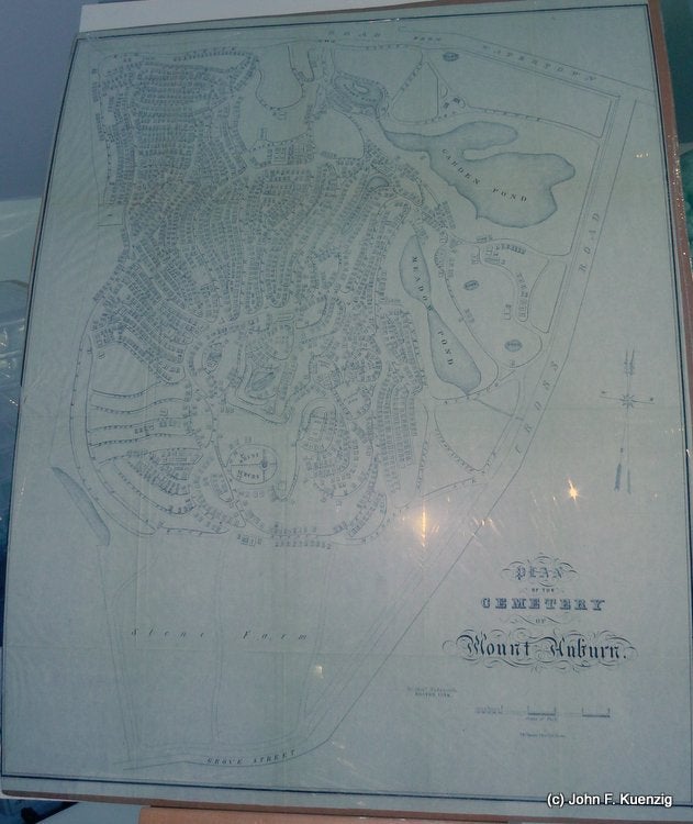
“STONE FARM. It has long been thought desirable that the Corporation should possess the estate called on the map The Stone Farm containing about sixteen acres occupying the whole space between the southern boundary of Mount Auburn and the southerly part of Coolidge Avenue This lot also surrounded and cut off from the Cemetery a gore of two or three acres already owned by the Corporation and which could only be made available when the intervening land should be procured. A negotiation was undertaken by Mr. Little one of the Board of Trustees and at a meeting on April 3d 1854 a letter was read from Mr. JB Dana of Cambridge addressed to Mr. Little as one of the Trustees offering to sell this estate to the Corporation on conditions therein named. After due consideration, it was unanimously voted “That it is expedient for this Corporation to purchase the Stone Estate now owned and offered to this board by JB Dana Esq and adjoining Mount Auburn on the southerly side containing about sixteen acres more or less with the buildings thereon and that the President with Messrs Little and Bangs be a Committee with full power to carry this vote into effect.” At the following meeting, April 22d the purchase was reported as being completed for the sum of $24,120 on the following valuation 16 acres at $1250 $20,000 1 rood 13 rods 420 Buildings per agreement 3,700 $24,120” (A History of the Cemetery of Mount Auburn By Jacob Bigelow)
While plans of the Mount Auburn cemetery in different formats are available (most often from the Dearborn guides), this plan showing the new layout after the Stone Farm purchase is much harder to find. It most closely resembles the 1831 Wadsworth plan in format, with the addition of the Stone Farm tract on the bottom. Not common, there are 5 copies in OCLC as of this writing, and no copies in the trade, RBH, or in the oldmaps database. Given the folds evident in the map, it was a pocket map, was mailed to someone or may have been issued with a pamphlet of some sort (most probably) discussing the Stone Farm tract acquisition. We have, as of this writing, been unable to find any such accompanying document, but cannot say for sure it does not exist.
Price: $475.00